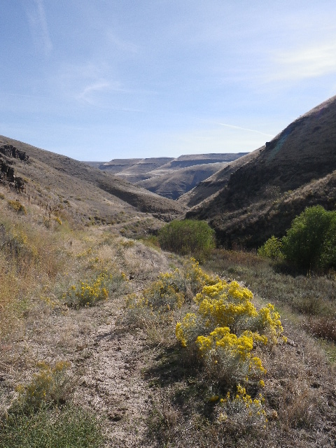
George Creek in Asotin
 Saturday was a fun run where I took a chance by leaping off onto the George Creek Trail in Asotin County without a real clear idea of where I would end up - or how long it would take to cover the ground back to the house.
There are two trail heads on the WDFW Land website. I used the second one, the Rockpile Parking Area. Directions are easy enough to follow:
Rockpile Parking Area: From Asotin, drive west up Asotin Creek Road and take a left on Cloverland Grade Road. Follow Cloverland Grade road up to the ridge top where the agricultural fields begin. Go approximately 5 miles to WDFW parking area on left side of road.
Once there, it was a matter of sliding through the gate to the abandoned jeep trail (this was very steep with a lot of loose rubble and overgrown) to the canyon floor. On the way down, you're guaranteed to get soggy shoes from a natural spring set to flow into watering tanks for horses. The overflow runs right across the trail.
Once I hit the canyon floor, there are multiple trails, some headed further up the canyon and the one I wanted, headed back down. The trail at this end is single track - it doesn't really widen for about 4 miles.
The trail follows Rockpile creek until it reaches George Creek. Rockpile was pretty much dry with a couple of soggy spots - I hope I can get out here in the spring when the creeks should all be full and the wildflowers in full bloom. As it was, there was typical desert sage and scrub grasses.
The first canyon intersection branched left toward home and right towards....I dunno. That will be an exploration when I have a little more base endurance. Saturday, I rolled left, scattering a herd of deer that were grazing on the lower meadows. Last I saw of them, they were cresting the steppe on the far side of the canyon.
The trail widens into a jeep track and then a dirt road as you get closer to the lower farms closer to town. It looks like there is a major effort by the Washington Department of Fish and Wildlife to create a sustainable watershed. From the tracks, it appears that they brought in heavy equipment to clear some brush and set logs to restrain debris flowing downstream under flood conditions. A bit further down, I found the backhoe clearing the creek bed to prepare a new bridge system.
The operator looked a little shocked to see me jogging down the trail - I get the impression that few people ever head out to George Creek despite its proximity to Asotin - but shut down the rig long enough for me to ford the creek- the third time I soaked my feet.
From there, it was an easy run to George Creek road, mostly gravel and a right turn onto Asotin Creek Road as I wound my way back to the house.
All in all, a nice intermediate run, maybe 12-13 miles long, and mostly in the solitude of the canyon.
